Spirit of Mawson
Veronika Meduna takes part in the first leg of the Spirit of Mawson expedition – joining scientists as they explore the subantarctic islands to study climatic change and its impact on the islands' ecology. The expedition retraced Douglas Mawson's voyage and carried out research across the region, building on the work from 100 years ago, to try to better understand present and future change in the Southern Ocean and Antarctica.
The World's Loneliest Christmas Tree

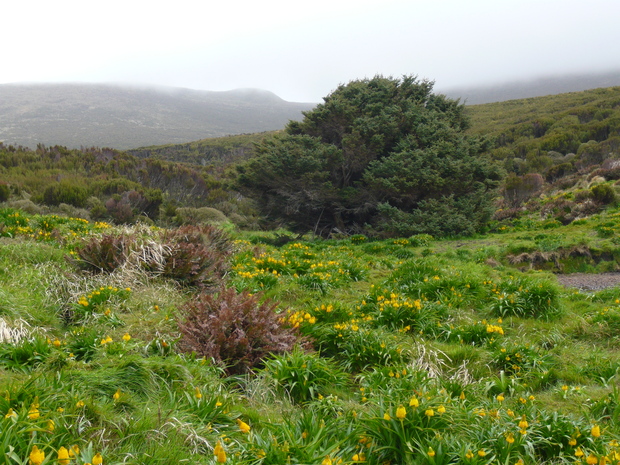
The world's loneliest tree, a Sitka spruce, stands among flowering megaherbs on New Zealand's southern-most subantarctic island. (images: V Meduna)
Campbell Island is New Zealand’s southern-most subantarctic island, some 700 km south of Bluff. It is home to some of the cloudiest weather in the subantarctic region, with fewer than 600 hours of bright sunshine and only 40 days per year without rain.
 The island is also home to an unruly Sitka spruce, known as the world’s loneliest tree in the Guinness Book of World Records. Its nearest taxonomic cousins live far away in the Northern Hemisphere, and there are no other introduced trees on Campbell Island. But despite being so out of place and in such a rugged climate, the tree is thriving. Except perhaps that it has grown into a shape that is more akin to a giant cauliflower than a tree.
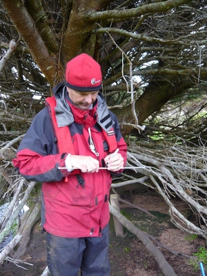
The spruce is sometimes also referred to as the Ranfurly’s tree because it is thought that Lord Ranfurly, governor general of New Zealand at the turn of the 20th century, planted it sometime between 1901 and 1907. During the first leg of the Spirit of Mawson expedition, Jonathan Palmer (left), who is part of the University of New South Wales' palaeoclimate consortium, took a core sample from the tree in the hope that its tree rings would reveal climate information for the past century. However, he found that even the thickest branches are only about 46 years old, which suggests that the spruce may well have once grown in its more common straight shape, but that its main trunk ended up as a Christmas tree a few decades ago, during the period when the (now automated) meteorological station on Campbell Island was still staffed year round.
The Snares - Tini Heke
All images by Veronika Meduna
Friday 6 December 2013 – There are more sooty shearwaters on the Snares than there are seabirds in the British Isles – that’s how our onboard ornithologist Kerry Jayne Wilson introduced us to this island group.
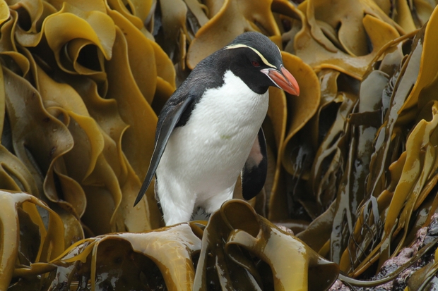
This is New Zealand’s closest subantarctic group, and the only forested islands that never had any introduced mammals, not even mice. Here, birds are in charge. The peat layer is honeycombed with sooty shearwater (Puffinus griseus) burrows, and the boulder beaches swarm with Snares crested penguins (Eudyptes robustus), which breed nowhere else. We spent the day exploring both the east and west coasts with zodiacs, watching penguins troop up and down the steep slopes between their nest sites and ocean launch pads. In one of the coves we even spotted a leopard seal which usually roams much closer to Antarctica, and on a tall granite tower on the west coast, we watched a breeding colony of cape petrels (which, according to Kerry Jayne, may not have been described yet).
In the afternoon, I caught up with our ecology team from Landcare Reseach, on their way back from the tree daisy forest on top of this island where they collected another peat core to explore whether the pollen signature has changed over the last millennium. But now, the long voyage home.
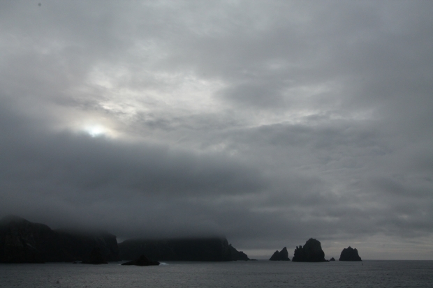
The Snares are a chip of the old block - 100 million-year-old granite that also makes up Rakiura Stewart Island.
Southern Ocean
Thursday 5 December 2013 – Two nights and a day at sea, en route to the Snares. Plenty of time to explore the ship.
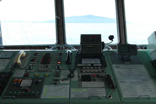
The view from the bridge of the Akademik Shokalskiy. She is an ice-strengthened ship, built in Finland in 1982, and was originally used for oceanographic research before being refurbished to operate as a passenger ship in both polar regions.

Our dining area, where we enjoyed three-course dinners, my cabin, and my favourite place on the bridge where the first mate usually sat poring over navigational charts.
Campbell Island - Motu Ihupuku, Northeast Harbour
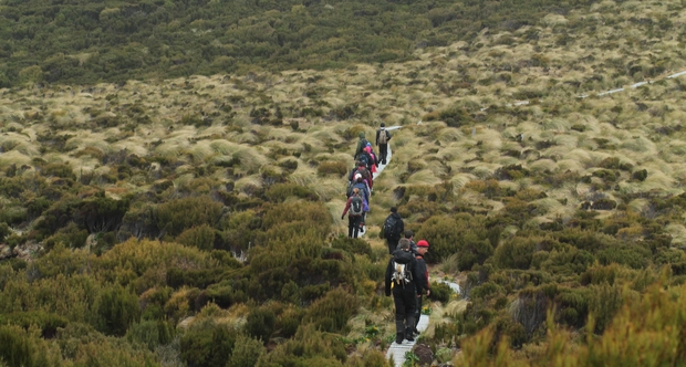
Clouds meeting us halfway up Campbell Island's Mt Lyall.
Wednesday 4 December 2013 – Campbell Island is an albatross metropolis. Six species breed here, which is more than on any other subantarctic island except Crozet in the southern Indian ocean. One of them, the Campbell mollymawk (Thalassarche impavida), breeds nowhere else. As we approached the island yesterday, all six species were circling the Shokalskiy, riding the winds effortlessly, not a single feather out of place.
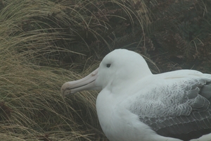 This morning, we were off to visit them on land. From the meteorological station, long decommissioned and empty, we snaked our way up along a boardwalk that leads to the wind-blasted ridges of Mount Lyall. Clouds wafted down to meet us halfway, but through the haze, we soon began to spot southern royal albatrosses on their nest pedestals. There is something regal about these huge seabirds, looking splendid on their thrones of mud and tussock. With a wingspan of more than three metres, royal albatrosses and their wandering albatross cousins are the world’s largest flying birds, and flying is what they do most of the time. Their home is really at sea, where they spend 90 per cent of their life, gliding close to the surface of the circumpolar Southern Ocean. The only reason they come on land is to produce the next generation, one egg at a time, every second year.
The megaherbs that surround the albatross nests are no less impressive, as Landcare Research ecologists Sarah Richardson and Matt McGlone were quick to point out. We are a bit too early for flowering, but nevertheless managed to find one brave specimen of a giant member of the carrot family, Anisotome latifolia, which was out in full bloom. Around it, the ground-hugging, dinner-plate-sized and furry leaves of Pleurophyllum, capturing what ever heat they can, and the glossy leaves of Bulbinella look almost tropical.
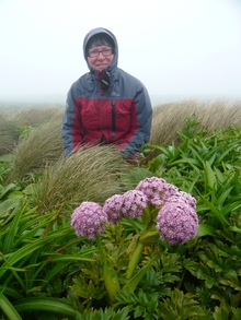 During the early decades of the 20th century, there were almost 7000 sheep on Campbell Island, and they liked the megaherbs too. But since the sheep have been removed, and particularly since rats have been eradicated from the island in 2001, these flamboyant plants are making a quick comeback.
So is one of the world’s rarest ducks. The flightless Campbell Island teal was once thought extinct, but was rediscovered on Dent Island, a small satellite off Campbell Island, in the 1970s. The Department of Conservation caught some of the birds to establish a captive breeding programme, but once Campbell was declared rat-free, about 100 teal were released back on their island home in 2006. Just a few years later, they seem to be doing just fine. As we were waiting for the zodiac to pick us up, two were happily pottering among the bull kelp, and some have even made their way back from Dent Island.
In the late afternoon, the Shokalskiy moved north to drop anchor off the entrance to Northeast Harbour. She couldn’t go any further into this narrow fiord because it is uncharted territory, but I had a lovely evening zodiac excursion to the end of the harbour to help Matt McGlone with a plant survey.
Campbell Island - Motu Ihupuku, Perseverance Harbour
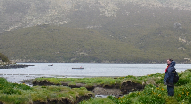
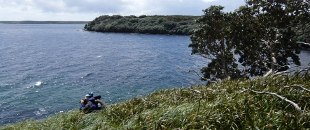
Looking out across the small Camp Cove, at the end of Perserverance Harbour.
Tuesday 3 December 2013 – We’re on our way to Campbell Island. At 52 degrees South, this is New Zealand’s southern-most subantarctic island group, and like the Auckland Islands, Campbell is a protrusion, a high point, in the vast underwater tablelands known as the Campbell Plateau. This extension in the south, the Bounty Plateau to the east and the Chatham Rise are all parts of New Zealand’s continental shelf, and the reason why we have the world’s fourth largest Exclusive Economic Zone, or EEZ.
As we approach Campbell, the difference in vegetation is obvious even from the distance. The rata and dracophyllum trees that grow on the islands in the Auckland archipelago may have been stunted and gnarly, but they still form a forest. On Campbell, there’s a fringe of low-growing dracophyllum but it quickly gives way to grasslands and fields of megaherbs. Like the Auckland islands, Campbell is an eroded shield volcano, which was active sometime between six and 11 million years ago. Long, fiord-like inlets and bays cut into its eastern coast, and we’re headed for the largest of these, Perseverance Harbour.
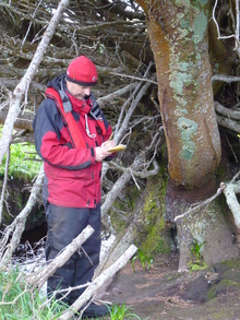
Jonathan Palmer, one of the scientists onboard the Shokalskiy, is a dendrochronologist at the University of New South Wales. Incidentally, I interviewed him only a week or two before this voyage about his work on Northland’s subfossil swamp kauri, and what its tree rings can tell us about past climates. Here, Jonathan hoping to extract information about past environmental conditions from this extraordinary tree. He took a 4mm core from one of its thickest branches, which measured almost half a metre in diameter, and the core showed a very healthy looking sequence of tree rings, some a few millimetres apart. Jonathan’s conclusion? This tree may be lonely, but it seems rather happy in its spot.
The most out-of-place tree on Campbell Island - a spruce in the middle of a field of tussocks and megaherbs, with Bulbinella rossii in flower.
Carnley Harbour, Emergency Bay
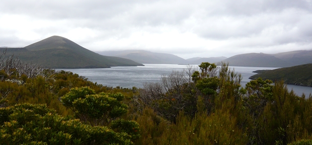
Monday 2 December 2013 – Low cloud, rain squalls and 50 knot winds – not exactly an improvement to the weather conditions this morning. Our Russian captain, Igor Kiselev, moved the Shokalskiy further into North Harbour in the hope that a birding party might be able to get ashore on Figure-of-Eight island. But even there the wind was too strong to lower the zodiacs into the water. We remained ship-bound for most of the day.
But that allowed me to join a team of geologists as they were deploying a multibeam sonar off the side of the ship to map the seabed in search of any hints about the islands’ glacial history. Charting swathes of 180 metres at a time, the reflected sonar signal gradually created a map of what the seabed looks like.
Current thinking suggests that 20,000 years ago, during the Last Glacial Maximum when sea levels were 125 metres lower than today, massive glaciers carved the landscape and created the fiords and inlets that mark today’s coastline. However, there is not much evidence on land of any large ice caps. Instead, cirques and other landforms are signatures of small glaciers. The sonar maps, combined with information from cores extracted from the seabed, may shed some light on the influence of glaciers on the volcanic landscape.
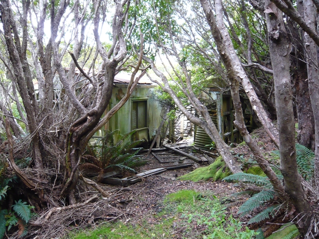
By late afternoon, the wind calmed and we finally got off the boat in Tagua Bay, the site of one of the coast watchers’ huts New Zealand established during the Second World War. In 1939, with a world war imminent, the German merchant ship Erlangen found herself on the wrong side of the enemy line in Otago Harbour. She departed in a hurry and under the cover of darkness, heading for the Auckland Islands. Her crew cut more than 200 tonnes of rata along the coast of Carnley Harbour to fuel the coal-fired burners during her voyage across the Pacific. The incident prompted the Cape Expedition, the code name for the deployment of small coastwatching parties to the Auckland Islands and Campbell Island. Among the coast watchers were a number of scientists, including Charles Fleming and Robert Falla, both of whom used their time to explore the islands and their geology, flora, fauna and climate.
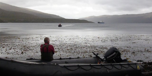
Carnley Harbour, North Arm
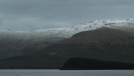
Sunday 1 December 2013 – It’s the first day of summer, but down here we woke up to a dusting of snow on the hill tops of Auckland Island. Overnight, we made our way from Port Ross in the north of the archipelago along the east coast of Auckland Island to Coleridge Bay in Carnley Harbour.
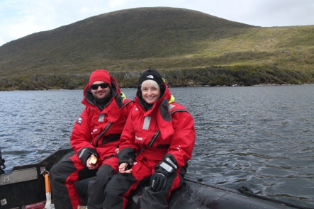
It seemed appropriate somehow, given that this archipelago is notorious for shipwrecks, to spend the day on the water. I headed out with Emma Johnston and Graeme Clark, marine ecologists from the University of New South Wales, to explore the ocean floor in the northern arm of Carnley Harbour. Although the temperature was hovering around 4ºC, our dry suits and thermal layers kept us all toasty as we deployed several steel frames, baited with cans of tuna, from a zodiac. Each of these contraptions also carried a camera to the seafloor, ready to record anything that would come crawling, swimming or floating to the bait.
Somewhere in this harbour, not far from where we were cruising around, rest the remains of the Grafton, one of at least eight ships that have come to grief around the Auckland Islands. In January 1864, the Grafton was en route from Campbell Island and anchored in North Arm when a vicious storm drove her onto the rocks. Her captain, Thomas Musgrave, and four other crew members built a hut from salvaged materials and survived on the island for 18 months before Musgrave and two others set out for Rakiura in the refitted dinghy. The voyage took five days, and Musgrave eventually managed to organise the rescue of the two remaining castaways.
Unbeknown to Musgrave’s crew, another ship, the Invercauld, was wrecked on the other side of Auckland Island not long after the Grafton. For a year, both groups endured the same misery, but neither knew of the other’s existence, until Musgrave discovered the body of an Invercauld seaman as he was returning to Port Ross aboard the rescue ship. Musgrave and Robert Holding, who emerged as a leader of the Invercauld castaways, both kept diaries, written in ink at first and later in seal blood. Of the 25 sailors who struggled ashore when the Invercauld was wrecked, only three survived.
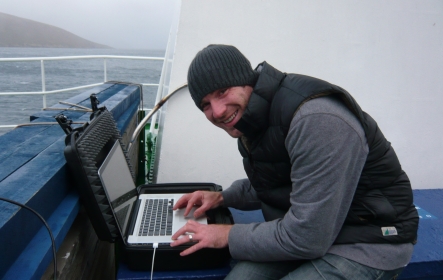
The weather turned foul in the afternoon, and I spent a good part of my evening up on the top deck in the howling wind and rain, trying to find a satellite signal to connect to the internet. I was only thanks to Anthony Ditton, still smiling despite the fact that his fingers were numb from the cold, that we eventually managed to upload at least a few images.
Ewing Island
Saturday 30 November 2013 - Today was a special treat. The back cover of Leonard Cockayne’s 1919 book on New Zealand Plants and their Stories shows the man himself, photographed on Ewing Island, next to a man-sized tussock (poa litorosa), growing on the fringe of a scrub forest of tree daisies (Olearia lyallii). Today, the forest has taken over most of the island and we could no longer find the tussocks. Instead, we spent the day crawling over and under the spectacularly gnarly branches of the tree daisy, in search of petrel burrows.
Ewing Island is one of the smaller islands in the Auckland Island group, and unlike the main island and Enderby, it never had any animals introduced to it. It remains a true seabird island. Only a few metres from our drop-off point on a rocky beach, we spotted eight giant petrel nests close to each other, each with a downy chick the size of a goose watching us, seemingly fearless. Further inside the scrubby scramble of branches, we found a few patches of small feathers, deposited by yellow-eyed penguins during their moult. And throughout the peaty forest floor, burrow after burrow showed signs of occupation, and in some cases even the resident birds, including diving petrels and sooty shearwaters.
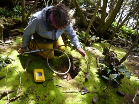
Ornithologist Kerry Jayne Wilson explores a seabird burrow with the help of a burrowscope, which has a light and camera at one end and a radio receiver at the other to transmit the image to a small screen.
Enderby Island
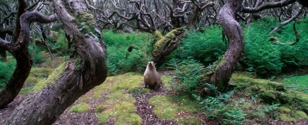
At its southern limit, southern rata grows into a goblin forest of twisted and stunted trees on Enderby Island.
Friday 29 November 2013 – Enderby Island is the resort island in the Auckland Island group. Low-lying and east of the mountains, it usually gets the finest weather and has a long stretch of golden beach at Sandy Bay.
This bay is the best place to land a Zodiac, and most of us got dropped off there in the morning to explore the rest of the island. I was keen to find out about its settlement history and joined Landcare Research palaeo-ecologist Janet Wilmshurst, who was taking cores from Enderby’s peat bogs in search of any evidence of pre-European habitation.
 A decade earlier, Atholl Anderson and his team had returned to Sandy Bay for an archaeological excavation. They were following up on an earlier dig during which they found chert and basalt flakes and a small midden with charcoal and bird and seal bones, one even marked with dog bites. In 1989, another expedition had uncovered a fishhook, fashioned from seal ivory – all suggesting that Polynesian navigators may have ventured this far south long before the European discovery of the Auckland Islands.
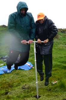
Radio-carbon dating of several items showed that people had indeed lived here, probably only briefly, around 700 years ago and possibly within a generation of the settlement of New Zealand, which makes Enderby Island the southern-most Polynesian settlement. Janet’s aim is to add palaeo-ecological evidence to the archaeological signature of human presence. She managed to core two metres deep into the peat (which required a lot of physical effort as it turned out), and back in time well beyond any human presence. The next task will be to sift through the peat layers looking for charcoal that pre-dates European discovery of the islands in 1806.
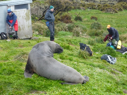
When we landed in Sandy Bay, a boisterous welcome party was already waiting. This beach is one of four breeding spots for the world’s rarest sea lion species, the New Zealand or Hooker’s sea lion (Phocarctos hookeri). At this time of the year, the burly beachmasters are sorting out their territories and building their harems, and they greeted us with an impressive performance of just how quickly they can move their huge bulk.
Hunted to near extinction during the early to mid-1800s, the population (fewer than 10,000) has now retreated to the Auckland Islands group, but this concentration on a handful of beaches makes them vulnerable. Disease epidemics have killed a large proportion of pups during some seasons, and tagging shows a marked decline in births over the last decade. Although New Zealand sea lions are fully protected, the squid fishery, which started around the islands in the 1980s, kills a certain number each year as legal by-catch.
Auckland Islands
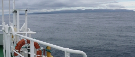
Thursday, 28 November 2013 – For part of the night, the Southern Ocean fulfilled its promise of messy seas, but by early morning, conditions were calm and most of us turned up for breakfast and for some more birdwatching on the bridge.
In fact, conditions were so calm that we reached our destination sooner than expected and, by late afternoon, could sea the silhouette of the Auckland Islands on the horizon. When botanist Joseph Hooker visited these islands in 1840 as part of James Clark Ross’ legendary expedition to Antarctica, he suggested that ‘perhaps no place in the course of our projected voyage in the southern ocean promised more novelty than the Auckland islands’. He also thought that the plants he collected were more beautiful than the flora of any other country and named one of the megaherbs found here, Bulbinella rossii, after Ross.
On our first evening in the Auckland islands, the Shokalskiy sailed into Port Ross and dropped anchor in Erebus Cove. There was only enough time left in the day for a short visit ashore to explore the historic Hardwicke settlement. It is difficult to imagine that at the height of this short-lived attempt to establish a whaling station on Auckland Island in 1847, more than 300 people lived along a short stretch of this coastline. Today, the stumps of the rata that had been cut down at the time have resprouted and the trees’s canopy again covers the coast. Perhaps the only hints of human impact, at least on first sight, are a few flaxes, most probably introduced by Ngati Mutunga Maori who had arrived here with their Moriori slaves a few years before the European settlers.
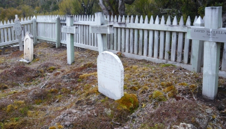
Just a short walk into the rata forest, though, the cemetery stands as a poignant symbol of the hardship these settlers experienced. One of the headstones, for Isabel Younger who died aged three months on 19 November 1850, is made from a millstone, which was probably never used for its original purpose. The settlers had envisaged a prosperous township based on whaling, but they were soon disheartened. There weren’t any whales to catch, few ships visited, crops failed. The Hardwicke settlement lasted less than three years and counts as one of the briefest colonial experiments.
Some of the other graves are those of shipwrecked mariners, many of whom arrived a generation later.
Off to the Subantarctic Islands
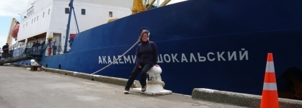
Wednesday, 27 November 2013 – Any ocean voyage is a major exercise in logistics, but after a few hours of waiting, luggage checks and security inspections, we finally boarded the Akademik Shokalskiy in the afternoon. For me, this was a special reunion. This Russian research vessel had taken me on a my first subantarctic voyage some 15 years ago, and I still remember the rough seas we had on the way to the Snares, the most-northern of New Zealand’s subantarctic island groups.
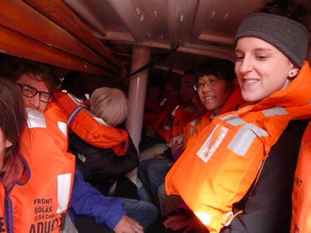
This time, our first stop would be 450 km further south, at the largest of these remote outposts, the Auckland Islands, and the forecast was again for ‘messy seas’. Before we could leave the harbour, the mayor of Invercargill, Tim Shadbolt (never one to miss a photo opportunity) came to see us off, then everybody settled into their cabins and tried to become familiar with life onboard a ship, including a lifeboat drill.
It was late afternoon when we sailed out across Foveaux Straight and along the rugged western coast of Rakiura Stewart Island – and out towards the Furious Fifties. The time was perfect to watch hundreds of sooty shearwaters (Puffinus griseus) return home to their burrows on the titi islands off Stewart Island. These ‘consummate seabirds’ in the words of our onboard ornithologist Kerry Jayne Wilson are impressive both above and under water. They are long-distance travellers, migrating to the Northern Hemisphere each year between breeding seasons, and making long foraging trips when they are nesting, sometimes all the way to the northern edge of the Antarctic pack ice and back in just a few days. Under water they use their wings to propel them down, in pursuit of prey, to depths of more than 60 metres.
I spent the rest of this first evening at sea on the bridge with Kerry Jayne, spotting several species of albatross, petrels and prions cruising along with our vessel.
Australasian Antarctic Expedition 2013 - 2014
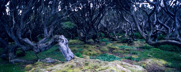
On Wednesday, November 27, a team of scientists, teachers and members of the public will depart on the first leg of the Spirit of Mawson expedition, traversing the same region Australian explorer Sir Douglas Mawson navigated a century earlier.
Douglas Mawson was a geologist and Antarctic explorer, and along with Roald Amundsen, Robert Falcon Scott and Ernest Shackleton, he was a key expedition leader during the Heroic Age of Antarctic exploration. He first travelled to Antarctica as part of Shackleton’s British Antarctic Expedition, aboard the Nimrod. In March 1908, he was one of the first party to climb Mount Erebus, and the following summer Edgeworth David, A. F. Mackay and Mawson were the first to reach the vicinity of the South Magnetic Pole, manhauling their sledges for more than 2000km.
In December 1911, with substantial private and government backing, Mawson set sail again to lead the Australasian Antarctic Expedition. His teams pursued scientific investigations in many disciplines, including geology, cartography, geomagnetism and biology, as well an extensive marine science programme from aboard the Aurora.
The Spirit of Mawson expedition will retrace Mawson's voyage and carry out research across the region, building on the work from 100 years ago, to try to better understand present and future change in the Southern Ocean and Antarctica. You can listen to expedition leader, climate scientist Chris Turney, as he explains what he hopes the expedition will achieve.
The expedition’s ship, the MV Akademik Shokalskiy, is a fully ice-strengthened polar and oceanographic research vessel. On-board the ship will be a range of high-tech vehicles, from submersibles that can travel independently across the ocean for years at a time, submersible robot arms and even remotely operated aerial drones.
Veronika Meduna will take part in the first leg to join scientists as they explore the subantarctic islands to study climatic change and its impact on the islands' ecology. This real-time blog lets you follow their discoveries.
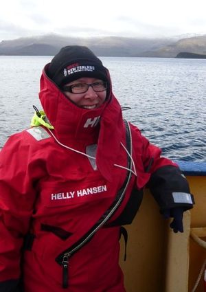
Veronika Meduna
